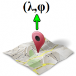
Converts street addresses (which are given in an *.xls file)
to geographic coordinates (longitude [λ] and latitude [φ]).
Contents:
Download | Screenshots | Program Description | Usage | Notes | Test Data | Credits
This application is portable: it does not need installation.
Just download it, extract the zipped folder, copy it wherever you like and run the executable.
Windows ![]()
Download Adress2crds – Windows.zip [version 3.0]
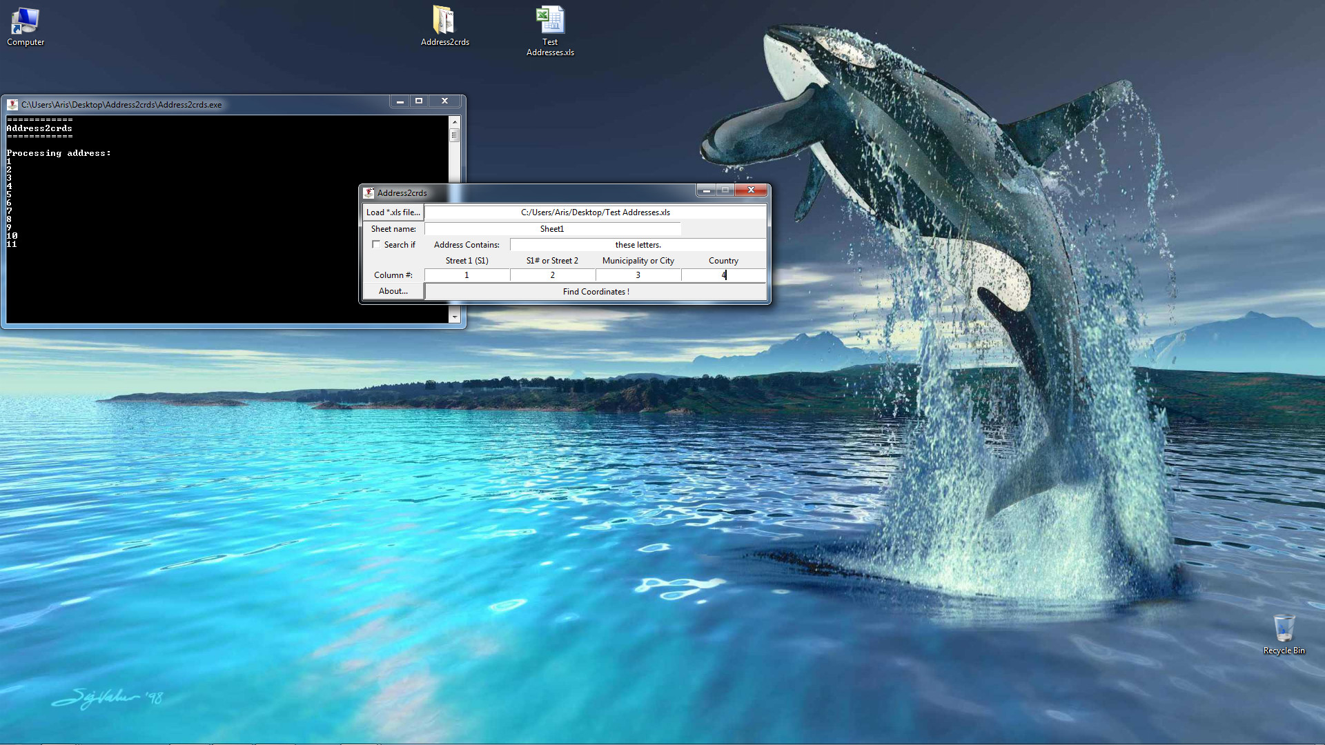
Figure 1: Running Address2crds on Windows 7. Currently the program is processing the addresses stored in the sample test data file.
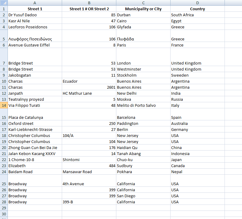
Figure 2: Screenshot of a sample input file. Download these test addresses.
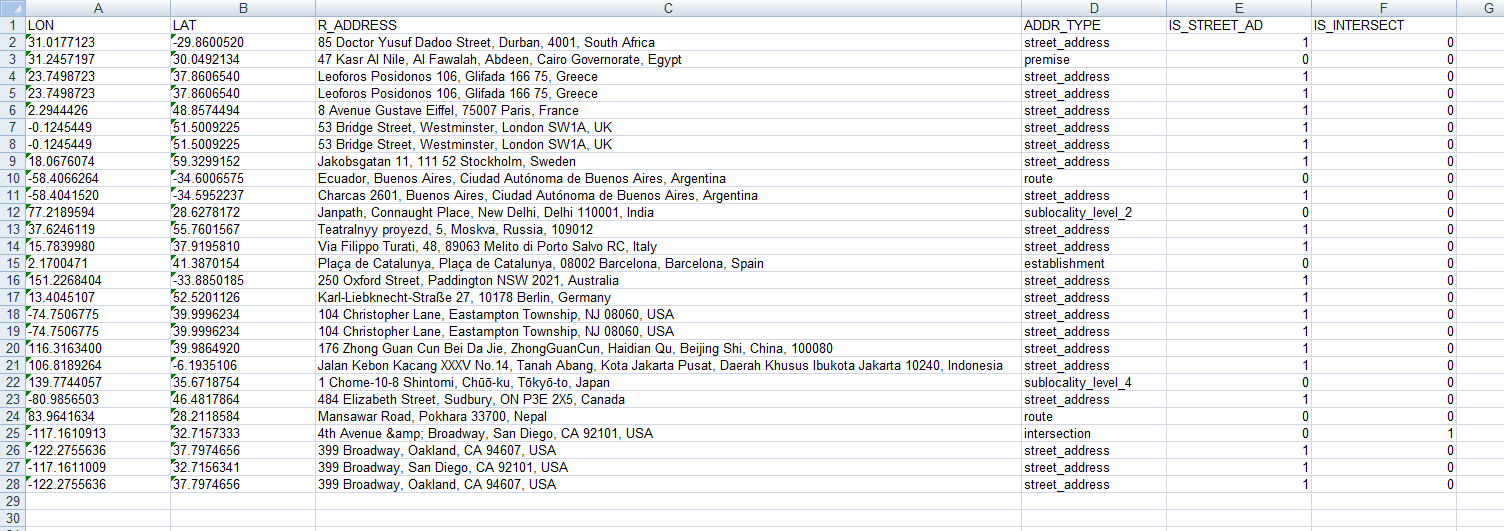
Figure 3: Screenshot of Address2crds output file.
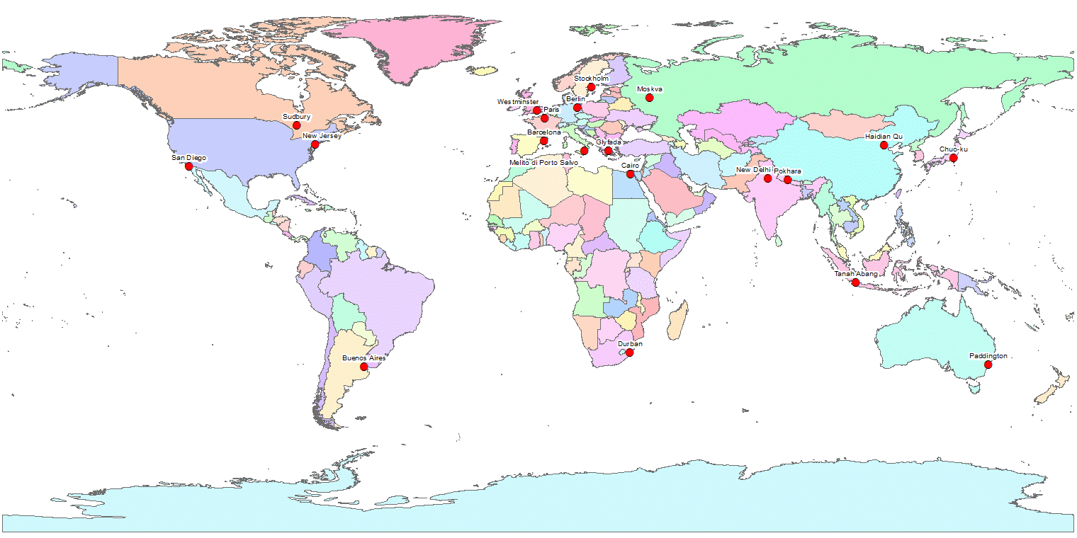
Figure 4: Importing the geographic coordinates of the street addresses from the Excel file produced by Address2crds (fig. 3) to the ArcGIS program. Apart from visualization, one can now perform various spatial analysis tasks and extract valuable information from the address points and their metadata.
The current application converts addresses which are stored in a .XLS file, to geographic coordinates.The Excel file must have the address information organized in 4 columns. Specifically, the columns should have the following address elements:
- Street 1
- Street 1 number OR Street 2 (Intersecting street)
- Municipality or City [Municipality preferred]
- Country
After the processing of the addresses, the program writes a new Excel file, which contains, among other information, the geographic longitude and latitude. The coordinates are expressed in the WGS ’84 Geographic Projection System.
1) Load the Excel file with the street addresses by clicking the “Load *.xls file…” button.
2) A new window will appear, which will help you locate the file on your computer. Find it, select it and click “Open”.
3) Type the name of the spreadsheet which contains the addresses you want to process, in the respective text field.In Microsoft Excel, the sheet name can be seen near the down-left corner of the interface. Usually, it is “Sheet1” (without the quotes) if you haven’t edited the name.
4) Update the “Column #” row with the numbers of the columns that contain the respective address elements. Notice that the columns should be given as numbers, instead of letters. For example, if the Country column in Excel is in column “D”, we should input it as “4” (without the quotes) in Address2crds program.
5) Click the “Find Coordinates !” button.
6) If everything went well, you will see the current number of the address being processed in the console window.
7) When the processing has finished, you will get a “Job :Done !” message and the geographic coordinates will be written in a new Excel file named “Address2crds_Output.xls”, which will be placed in the same folder with the input file.
8) Open the results file. You will see the columns with the geographic longitude and latitude and a third column named “R_ADDRESS”. This column refers to the actual address these coordinates correspond. If this address matches the address given in the input file, then Congratulations! You have found the correct coordinates of the address!
9) You can now easily import your addresses in a GIS and visualize them in a map, study their spatial characteristics and do whatever else you need to do with them.
1) This application requires a working Internet connection.
2) Download and read the comments of the example data.
3) At the time of writing, there is a limit of 2500 requests per 24 hours and IP address. If exceeded, the addresses will not convert. There is also a limit of 5 requests per second, but this is unlikely to be exceeded (except if using simultaneously 2 or more instances of the program on the same WAN IP). These limits have been set by Google. See Credits.
4) Try to avoid giving addresses as intersections. If the street number is known, prefer it over intersecting street, since tests have indicated that street-number addresses have higher conversion success than street-street addresses.
5) Always give Municipality instead of City, when Municipality name is available. A street name can occur twice or more in a City. This changes if you give intersections, but you should avoid intersections as mentioned in the previous note.
6) Be careful of typographic errors in your input file.
7) Avoid abbreviations.
8) You can use the native language of the country for the first 3 address elements. For example, if all the addresses where in Russia, then the first 3 columns could be in the Russian alphabet. However, the column of the Country is always advised to be in English.
9) Even if you do everything correctly, some addresses coordinates might fail to convert properly. Fortunately, you can spot which addresses failed using the “R_ADDRESS” column and either modify the input file and retry, or search them manually.
10) In some rare occasions, the addresses might take very long to process (i.e 5 or more seconds to resolve a single address instead of fractions of a second). If this happens, try using the program in a system with different IP address.
Here you can download the sample file (featured in figs. 2-4) with test addresses from the 6 inhabited Continents of the World:
Most of the coordinates of the addresses are found successfully using the Address2crds application, as you can verify yourself. Read and follow the tips of the comments column, for best results.
This program proudly utilizes Google Maps technology.